Routes
2024 Sunday in June Routes
The 2024 routes are currently available as image files (png). Ride with GPS files will be available in May.
Enjoy Geauga County’s well-maintained roads over rolling hills through farms, maple groves and the largest Amish community in Ohio. It’s a great place to explore on two wheels! And, Sunday in June offers a total of four ride distances, made up of three individual routes. There’s an entry-level 25-mile loop to a Metric Century and full Century – a route distance for practically everyone at every ability level (25, 40, 65 & 100 approximate mile route distances)!
Now Download maps, cue sheets, and create GPS device data files (We don’t create GPS data files for you due to rider customization preferences.)
The four RIDES are made up of combinations of the following three ROUTES, in the following order:
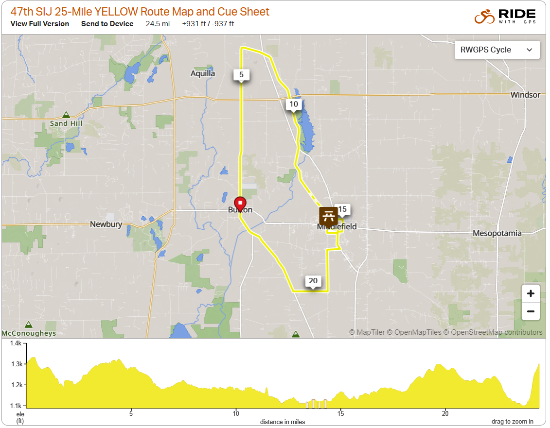
- 25-mile ride distance = 25-mile yellow route
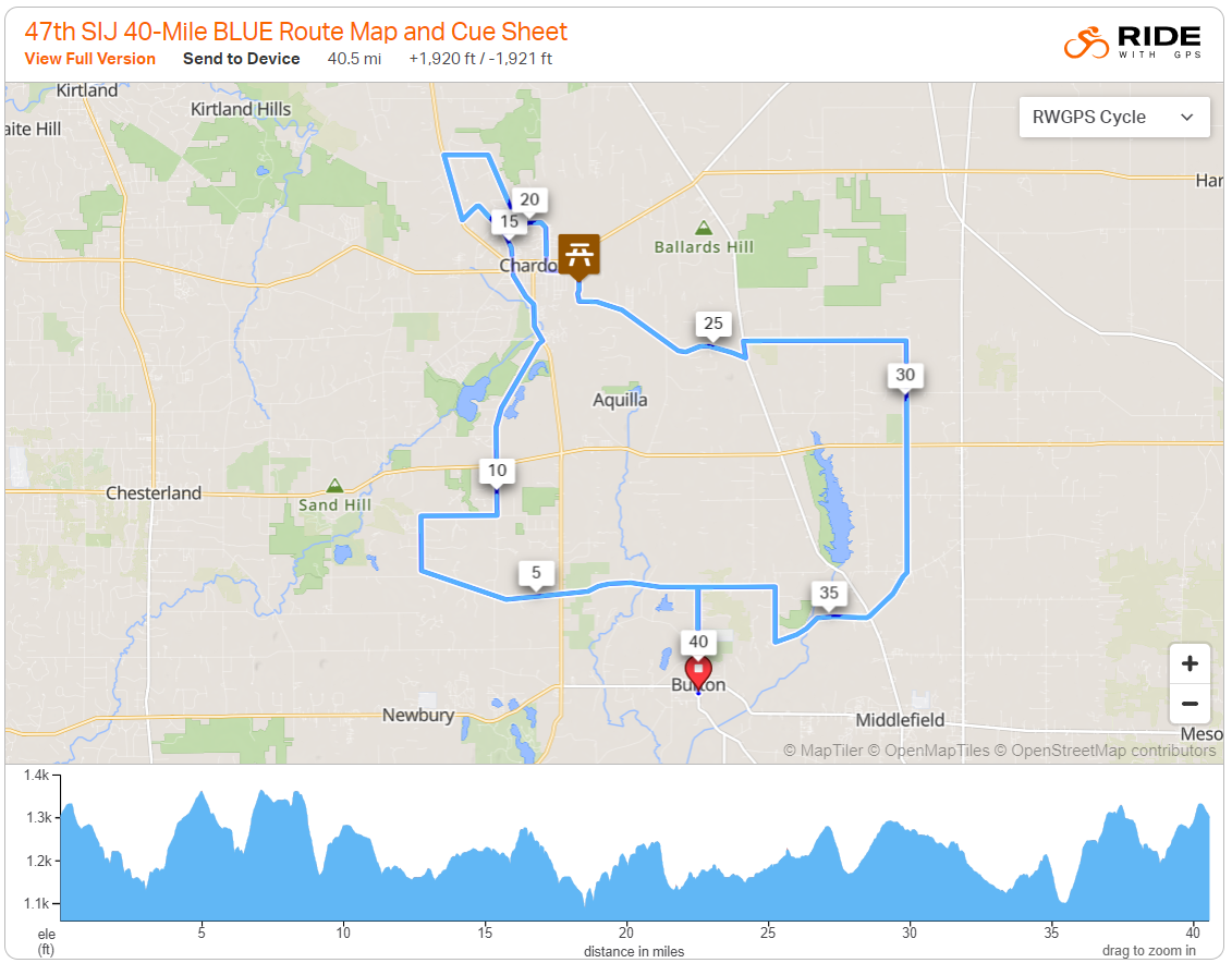
- 40-mile ride distance = 40-mile blue route
- 65-mile ride distance = 40-mile blue route + 25-mile yellow route
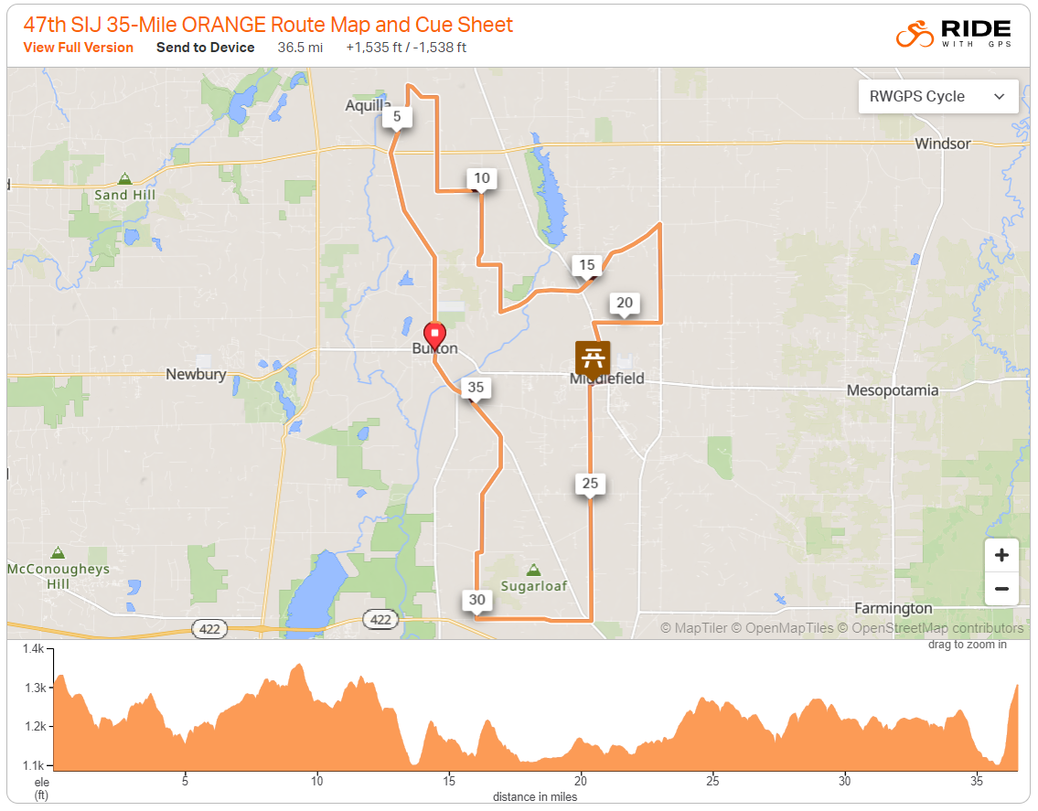
- 100-mile ride distance = 40-mile blue route + 35-mile orange route + 25-mile yellow route
25-Mile Yellow Route
This route serves as the entire 25-mile ride, the second leg of the 65-mile ride and the third leg of the 100-mile ride.
Download the map and que sheet in PDF format.
See the map in Ride with GPS:
35-Mile Orange Route
This route serves only as the second leg of the 100-mile ride.
Download the map and cue sheet in PDF format.
See the map in Ride with GPS:
40-Mile Blue Route
This route serves as the entire 40-mile ride, the first leg of the 65-mile ride and the first leg of the 100-mile ride.
Download the map and cue sheet in PDF format.
See the map in Ride with GPS:
Rest Stops
Don’t miss Sunday in June’s laid-back rest stops. Kick back in the grass, munch on a snack, have a banana, and re-hydrate! Also, don’t be surprised if you coast into one of the rest stops and see some familiar faces!
Rest stops will be loaded with in-season fresh fruit, sports drinks and plenty of spring water to fill your bottles.
We’ll have bicycle mechanics at all rest stops, and if have a mechanical/other problem call the phone number shown on your map for support in case of a breakdown or emergency. For a serious emergency, first call 911, then call the ride support number on your map.
Stops are located at intervals appropriate to everyone. If it is a hot and humid day, we will provide additional water at key locations on the route. Rest areas close at different times. If you change from the intended route, check the rest stop schedule provided with your registration materials. If you need assistance or fluids anywhere in the ride, call the ride support number on the map.
SAG Support
Vehicles will assist fatigued riders or those with mechanical failure. If you have a breakdown, are overheated or for any reason would like assistance of any kind, call the ride support number on your Sunday In June map.
Bicycles must be in good mechanical condition. Be prepared to perform basic repairs on your own, such as flat tires. It is recommended you carry basic tools including: a spare tube, patch kit, pump and two or more water bottles.
SAG vehicles will do a final “sweep” of all routes between 3:00 and 4:00 PM. Plan and pace yourself accordingly for your safe and timely return to ride start.
Trail Etiquette
Parts of all routes take you on the paved Maple Highlands Trail. It is peaceful and scenic and takes you over three covered bridges. Here are some tips from the Geauga Park District for riding on the trail:
- Bikes yield to walkers. On the South Section, both bikes and walkers yield to horses.
- Keep right except to pass. Pass with caution.
- Announce that you are passing so as not to startle others.
- Move off trail when stopped.
- Yield to all law enforcement, maintenance and emergency vehicles.
- Respect private property; stay within trail corridor.
- Obey all traffic signs, especially stop signs.
- Yield to cross traffic at all intersections.


